Hiking and Biking Trails
The Alabama Reunion Trail
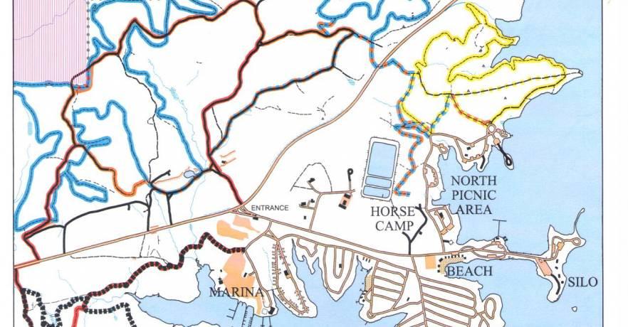
This moderate to difficult trail is approximately 3.8 miles in length and traverses both hardwood bottoms and pine forest. The trail is bisected by highway 128 and marked with red blaze its entire length. The trail is actually a loop with its beginning and end in close proximity. Several natural features can be noted, which include an old home site on the northern half, picturesque hardwood bottoms, stands of pine, beds of fern and an abundance of bird and animal life.
The North Side is approximately 1.95 miles and the South Side is 1.8 miles.
The Alabama Reunion Trail is marked in red below.

The Campfire Trail
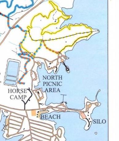
This trail begins and ends in the northern section of the Park. Rated primarily moderate with several steep areas, this trail is approximately 1.8 miles in length and marked by a yellow trail blaze. The three connectors, blue, white and orange, are approximately 1/5 mile each. During the spring, white dogwood, buckeye and oak leaf-hydrangea paint the hardwood ridges with brilliant color. This trail traverses both mixed hardwood forest and intermittent pine. Midway up the trail, a series of rock outcroppings occurs bordered by an abundance of ferns. Toward the end of the trail, a small stream bisects the path leading south. Thanks to the Vulcan Orienteering Club and Eagle Scout Josh Sumner for the Wind Creek Orienteering Course.
Wind Creek Orienteering Course Map
Wind Creek Orienteering Course Description.
The Campfire Trail is marked in yellow below.

