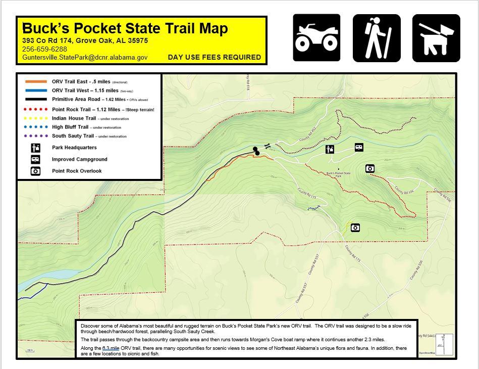
Hiking Trails


The park offers an abundance of hiking trails—over 15 miles to explore—so you're sure to find a favorite. Whether you're in the mood for a short walk along the Indian House Trail, where ancient rock overhangs once provided shelter for Native Americans, or a longer trek to the lake via the Primitive Campground Trail for some fantastic fishing, there's something for everyone. For breathtaking views, hike up to the Point Rock Overlook—you might even catch a glimpse of a soaring bald eagle. Each trail promises a new adventure every time you visit.
Please note: A day-use fee of $5.00 is required for entry into the park. This fee supports the maintenance of trails and park facilities. Payment can be made at the park office, the digital kiosk (card only), or the honor box (cash only). All payment locations are conveniently located within the campground.
Point Rock Trail
- Length: 1.1 miles (one way)
- Difficulty: Moderate to Hard
This scenic trail begins at the floor of Bucks Pocket Canyon near the campground and climbs approximately 800 feet to the stunning Point Rock Overlook. Along the way, you’ll follow Little Sauty Creek, pass through lush vegetation with wildflowers and ferns, and encounter geologic formations estimated to be 200–250 million years old. The trail starts just across the Little Sauty Bridge and ends with a breathtaking view of the canyon.
Indian House Trail
- Length: 0.5 miles (one way)
- Difficulty: Easy to Moderate
This short, historically rich trail leads to rock overhangs once used by Cherokee Indians for shelter. In early spring, the path comes alive with blooming wildflowers and rhododendrons, offering a peaceful and culturally significant hiking experience.
High Bluff Trail
- Length: 0.5 miles (one way)
- Difficulty: Easy to Moderate (with some elevation)
The highlight of this trail is a massive beech tree of historical importance, standing near a rock overhang. A seasonal stream flows beside the trail during the fall and winter months, adding to the tranquil beauty of the hike.
South Sauty Creek Trail
Currently Under Renovation
- Length: 1.5 miles (one way)
- Difficulty: Moderate to Difficult
This trail offers a rugged journey through varied terrain, featuring two seasonal waterfalls, dense plant life, and scenic creekside views. The trailhead begins just beyond the main creek bridge on the right.
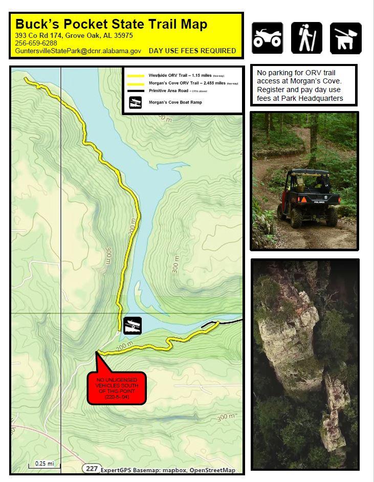
Primitive Camping Road Trail
- Length: 1.6 miles (one way)
- Difficulty: Moderate
- ORVs Allowed
The trail follows an old access road, now a peaceful path winding along the creek toward the primitive camping area (fees required). While the campground is still active, it is no longer accessible by standard vehicles—only by foot or ORV. Hikers will enjoy scenic views of boulder-filled creek beds, diverse plant and animal life, and a serene natural setting. The trail begins just before the main bridge and heads downstream, eventually connecting with the ORV Trail to the Morgan’s Cove area.